
GPS vs. AIS vs. EDI Tracking: How Shipment Data Actually Gets to You
Understand the differences between GPS, AIS, and EDI tracking and how each technology provides shipment data across road, ocean, and logistics operations.


When a logistics team checks the location or status of a shipment, it can seem like the information simply appears on a tracking dashboard. Behind that update, however, there may be several different technologies collecting, transmitting, and exchanging data. Three important technologies are GPS, AIS, and EDI. They serve different purposes, and understanding the difference can help businesses understand where shipment information comes from, how frequently it may update, and why tracking quality can vary across transportation modes.
What Is GPS Tracking?
GPS (Global Positioning System) uses satellite signals to determine the location of a device or vehicle. In logistics, GPS can be used to track:
- Trucks
- Trailers
- Containers
- Delivery vehicles
- Other connected assets
A GPS-enabled device determines its position and transmits that information through a communications network to a tracking platform. GPS is particularly useful for road transportation because businesses can monitor vehicle movement and receive location updates during a shipment.
What Is AIS Tracking?
AIS (Automatic Identification System) is primarily used in maritime transportation. Ships use AIS to transmit information such as:
- Vessel identity
- Position
- Speed
- Direction
- Navigational status
This information can be received by terrestrial stations, satellites, and other AIS-enabled systems. For ocean freight, AIS can help logistics teams understand where a vessel is and estimate its progress toward a port. However, AIS is primarily a vessel tracking technology. It does not automatically provide complete information about every individual container onboard a ship.
What Is EDI Tracking?
EDI (Electronic Data Interchange) is different from GPS and AIS because it is not primarily a location-tracking technology. Instead, EDI enables businesses and systems to exchange standardized electronic information. In logistics, EDI can transmit information such as:
- Shipment status
- Pickup confirmations
- Delivery updates
- Purchase orders
- Advance Ship Notices
- Invoices
- Transportation documents
For example, a carrier may send an EDI status message to a shipper's system when a shipment reaches a particular milestone.
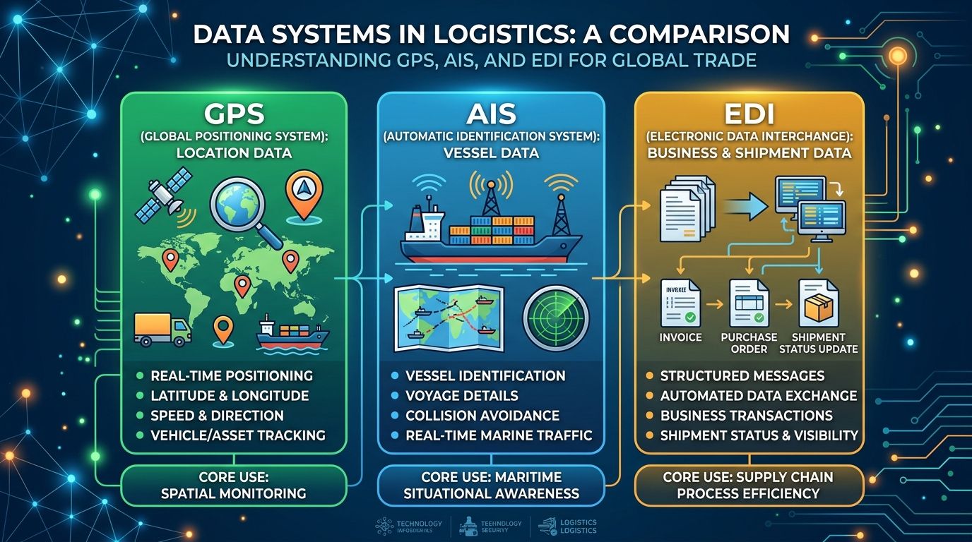
GPS vs. AIS vs. EDI
| Technology | Primary Purpose | Common Logistics Use |
|---|---|---|
| GPS | Position tracking | Trucks, vehicles, and connected assets |
| AIS | Vessel identification and position | Ocean and maritime tracking |
| EDI | Structured data exchange | Shipment statuses and business transactions |
| The key difference is that GPS and AIS primarily provide location or movement information, while EDI communicates structured operational information between systems. |
How Do These Technologies Work Together?
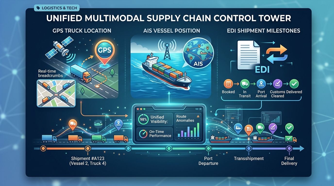
Modern supply chains rarely rely on just one source of information. Consider an international shipment moving from a factory to a customer:
- GPS can provide the truck's location while the shipment moves to a port.
- AIS can provide the vessel's position while the cargo is transported by sea.
- EDI can communicate shipment milestones between the carrier, shipper, forwarder, or other connected systems.
- A visibility platform can bring these different data sources together.
This is how businesses can create a more complete view of a multimodal shipment.
Why Data Integration Matters
A shipment can move through several transportation modes and involve multiple companies. If each participant provides information through a different system, logistics teams can end up working with fragmented data. The goal of a modern visibility platform is therefore not necessarily to replace every data source. It is to connect the information they provide. SupplySense 360 supports multiple integration methods, including API, EDI, spreadsheet uploads, and IoT-connected data, helping businesses bring information from different sources into a centralized supply chain visibility environment. This can give teams a clearer picture of shipment location, milestones, exceptions, and expected delivery times.
What Should Businesses Look For?
When evaluating shipment tracking technology, businesses should consider:
- Which transportation modes need to be tracked?
- How frequently should location data update?
- Which carriers and logistics partners need to connect?
- What shipment milestones are important?
- Do connected sensors need to be supported?
- Can different data sources be combined?
- How are exceptions identified and communicated?
The objective should be more than simply displaying a location on a map. Useful visibility means having the right information, from the right sources, at the right time.
Conclusion
GPS, AIS, and EDI each play different roles in modern logistics. GPS helps track connected assets, AIS provides maritime vessel information, and EDI enables standardized information exchange between business systems. When these data sources are connected, businesses can move closer to a unified view of their supply chain rather than relying on isolated tracking systems. SupplySense 360 helps bring multiple sources of shipment and logistics data together, giving teams the visibility they need to monitor shipments and respond to exceptions more effectively.